black silhouette country borders map liberia white background contour state vector illustration

navigate by keyword : abstract africa art background banner black border borders cartography chart concept connect continent contour country cut design detailed drawing geography graphic icon illustration infographic isolated land liberia map national network ocean outline patriotism pattern political republic shape sign silhouette state symbol territory texture transportation travel vector wallpaper white world

black silhouette country borders map of Liberia on white background. Contour of state. Vector illustration Royalty Free Stock Photo
Liberia flag map. The flag of the country in the form of borders. Stock vector illustration isolated on white background Royalty Free Stock Photo
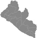
Vector isolated illustration of simplified administrative map Liberia. Borders of the counties. Royalty Free Stock Photo
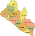
Vector isolated illustration of simplified n administrative map Liberia. Borders of the counties and names Royalty Free Stock Photo
White map of Liberia Royalty Free Stock Photo
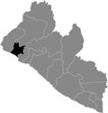
Location map of the Bomi county of Liberia Royalty Free Stock Photo
Map of Liberia black thick outline highlighted with neighbor countries Royalty Free Stock Photo
black silhouette country borders map of Liberia on white background. Contour of state. Vector illustration
White map of Liberia Royalty Free Stock Photo
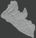
Dark topographic map of Liberia Royalty Free Stock Photo
Liberia Map Boundary Royalty Free Stock Photo
Black map of the Republic of Liberia Royalty Free Stock Photo
Light topographic map of Liberia Royalty Free Stock Photo
Gray map of Liberia Royalty Free Stock Photo
Pastel map of Liberia Royalty Free Stock Photo
Black silhouette country borders map of Liberia on white background. Contour of state. Vector illustration


Stockphotos.ro (c) 2025. All stock photos are provided by Dreamstime and are copyrighted by their respective owners.