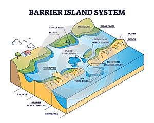
barrier island system dune type and coastal landforms outline diagram

navigate by keyword : barrier island system landforms type beach dune sand wave formation tidal mainland coast water geology outline diagram structure scheme geography labeled educational lagoon complex shoreface washover creek marsh flood delta flats secondary channel ebb main inlet dunes concept explanation land sediment chains offshore breakwater coastal morphodynamics backshore parallel current

Barrier island system as dune type and coastal landforms outline diagram Royalty Free Stock Photo
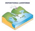
Depositional landforms and sediment created relief area types outline diagram Royalty Free Stock Photo


Barrier island system as dune type and coastal landforms outline diagram


Barrier island systems as dune type and coastal landforms outline diagram. Labeled educational beach with lagoon and shoreface structure formation description from geological side vector illustration.


Stockphotos.ro (c) 2025. All stock photos are provided by Dreamstime and are copyrighted by their respective owners.