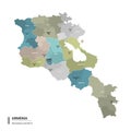
armenia higt detailed map with subdivisions administrative districts and cities name colored states |
||||||||||||||||||||||||||||||||||||||||
navigate by keyword : administrative aragatsotn ararat armavir armenia artashat ashtarak border capital cartography city color country destination district dzor editable gavar gegharkunik geography gyumri hrazdan ijevan kapan kotayk layer location lori map region separate shirak state subdivision syunik tavush template travel vanadzor vayots vector yeghegnadzor yerevan |
||||||||||||||||||||||||||||||||||||||||
|
||||||||||||||||||||||||||||||||||||||||
Armenia higt detailed map with subdivisions. Administrative map of Armenia with districts and cities name, colored by states and administrative districts. Vector illustration |
||||||||||||||||||||||||||||||||||||||||
Stockphotos.ro (c) 2025. All stock photos are provided by Dreamstime and are copyrighted by their respective owners. |