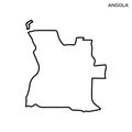
angola country map black silhouette and outline isolated white background eps vector

navigate by keyword : africa angola background black border boundary country eps geography graphic icon illustration isolated jpeg land map nation national outline republic silhouette vector white

Angola Country Map. Black silhouette and outline isolated on white background. EPS Vector Royalty Free Stock Photo
Angola Map. Black silhouette country map isolated on white background. Black outline on white background. Vector based Royalty Free Stock Photo
Angola Map. Angolan Country Map. Black and White National Outline Boundary Border Shapex Geography Territory EPS Vector Illustrati Royalty Free Stock Photo
Luanda, Angola. Detailed Country Map with Capital City Location Pin Royalty Free Stock Photo
Angola map - High detailed Black map with counties/regions/states of angola. Afghanistan map isolated on transparent background Royalty Free Stock Photo
Trinidad and Tobago map silhouette Royalty Free Stock Photo
South sudan Leone map silhouette Royalty Free Stock Photo
Angola Country Map. Black silhouette and outline isolated on white background. EPS Vector
Angola map - High detailed blue map with counties/regions/states of angola. angola map isolated on transparent background Royalty Free Stock Photo
Outline map of Angola vector design template. Editable Stroke. Royalty Free Stock Photo
Sri Lanka Leone map silhouette Royalty Free Stock Photo
Tunisia map silhouette Royalty Free Stock Photo
Taiwan map silhouette Royalty Free Stock Photo
Syria map silhouette Royalty Free Stock Photo
Switzerland\'s map silhouette Royalty Free Stock Photo
Angola Country Map. Black silhouette and outline isolated on white background. EPS Vector.


Stockphotos.ro (c) 2025. All stock photos are provided by Dreamstime and are copyrighted by their respective owners.