america map separate individual states with state names color isolated white background

navigate by keyword : america map separate individual states state names color isolated white background american north south united usa caribbean mexico brazil alaska canada vector world tourism travel administrative division atlas blue cartography colored colorful colors continent contour country design earth geography graphic green illustration regions mapping outline political region silhouette wall

America map, separate individual states with state names, color map isolated on white background Royalty Free Stock Photo
Central America map, separate individual states with state names, color map isolated on white background Royalty Free Stock Photo
Canada map, administrative division, separate individual states with state names, color map isolated on white background Royalty Free Stock Photo
Caribbean islands Central America map, new political detailed map, separate individual states, with state names, isolated on white Royalty Free Stock Photo
World map, separate continents whit names, blue background Royalty Free Stock Photo
Caribbean islands and Central America map, individual states and islands and city whit names , blue background Royalty Free Stock Photo
America map, separate individual states with state names, color map isolated on white background
Mexico map, new political detailed map, separate individual states, with state names, isolated on white background 3D Royalty Free Stock Photo
Mexico map, new political detailed map, separate individual states, with state names, isolated on white background 3D blank Royalty Free Stock Photo
America map, separate states whit names, blue background Royalty Free Stock Photo
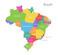
Brazil map, administrative division, separated individual regions with names, color map isolated on white background Royalty Free Stock Photo
Rio de Janeiro map state and city with Brazil administrative division, separate individual regions with names, color map isolated Royalty Free Stock Photo
USA map with Alaska and Hawaii map, new political detailed map, separate individual states, with state names, isolated on white ve Royalty Free Stock Photo
USA map with Alaska and Hawaii map, new political detailed map, separate individual states, with state names, isolated on white Royalty Free Stock Photo
America map, separate individual states with state names, color map isolated on white background vector


Stockphotos.ro (c) 2025. All stock photos are provided by Dreamstime and are copyrighted by their respective owners.