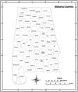
alabama map state and district administrative political with outline black white

navigate by keyword : alabama america background banner blue business cartography city continent contour county design earth federal geography global globe graphic home icon illustration international isolated label line map national north outline phenix planet region set shape silhouette stamp star state states symbol tour tourism travel united usa vector world

Alabama state outline administrative and political vector map in black and white Royalty Free Stock Photo
Alabama Map. State and district map of Alabama. Administrative and political map of Alabama with outline and black and white Royalty Free Stock Photo
Iowa Map. State and district map of Iowa. Political map of Iowa with outline and black and white design Royalty Free Stock Photo
Map of Henry County in Alabama state on white backround. single County map highlighted by black color on Alabama map. UNITED Royalty Free Stock Photo
Map of coosa County in Alabama state on white backround. single County map highlighted by black color on Alabama map. UNITED Royalty Free Stock Photo
Map of Geneva County in Alabama state on white backround. single County map highlighted by black color on Alabama map. UNITED Royalty Free Stock Photo
Map of Wilcox County in Alabama state on white backround. single County map highlighted by black color on Alabama map. UNITED Royalty Free Stock Photo
Alabama Map. State and district map of Alabama. Administrative and political map of Alabama with outline and black and white
Map of Macon County in Alabama state on white backround. single County map highlighted by black color on Alabama map. UNITED Royalty Free Stock Photo
Map of perry County in Alabama state on white backround. single County map highlighted by black color on Alabama map. UNITED Royalty Free Stock Photo
Map of Marion County in Alabama state on white backround. single County map highlighted by black color on Alabama map. UNITED Royalty Free Stock Photo
Map of Shelby County in Alabama state on white backround. single County map highlighted by black color on Alabama map. UNITED Royalty Free Stock Photo
Map of Monroe County in Alabama state on white backround. single County map highlighted by black color on Alabama map. UNITED Royalty Free Stock Photo
Map of Clarke County in Alabama state on white backround. single County map highlighted by black color on Alabama map. UNITED Royalty Free Stock Photo
Map of Dallas County in Alabama state on white backround. single County map highlighted by black color on Alabama map. UNITED Royalty Free Stock Photo
Alabama Map. State and district map of Alabama. Administrative and political map of Alabama with outline and black and white design


Stockphotos.ro (c) 2025. All stock photos are provided by Dreamstime and are copyrighted by their respective owners.