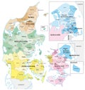
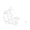
administrative and political vector outline map the kingdom denmark

navigate by keyword : abstract administrative and art background border capital cartography city concept contour copenhagen country danish danmark denmark detailed europe european geography germany graphic illustration image island isolated jutland kingdom kommuner map municipalities nation national nordic north outline peninsula political province region regional regions scandinavia shape surface sweden topography travel vector view world

Administrative and political vector outline map of the Kingdom of Denmark Royalty Free Stock Photo
The Kingdom of Denmark map, administrative divisions. Denmark vector map and its two autonomous territories: the Faroe Islands and Royalty Free Stock Photo
Denmark political map of administrative divisions Royalty Free Stock Photo
Highly detailed editable political map with separated layers. Denmark. Royalty Free Stock Photo
Administrative and political vector outline map of the Kingdom of Denmark
Denmark political map of administrative divisions Royalty Free Stock Photo
Highly detailed editable political map with separated layers. Denmark. Royalty Free Stock Photo
Denmark Administrative map. Blue colors Royalty Free Stock Photo
Denmark political map of administrative divisions Royalty Free Stock Photo
Political and administrative vector map of northern europe with state borders Royalty Free Stock Photo
Administrative and political vector outline map of the Kingdom of Denmark.


Stockphotos.ro (c) 2025. All stock photos are provided by Dreamstime and are copyrighted by their respective owners.