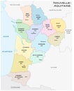
administrative and political vector map the region nouvelle aquitaine france

navigate by keyword : administrative and aquitaine atlantic background border capital cartography city color colorful contour country design district europe france geography graphic illustration image land map national nouvelle nouvelleaquitaine ocean outline political province region spain state travel vector west

Administrative and political vector map of the region Nouvelle-Aquitaine, France Royalty Free Stock Photo
Administrative and political vector map of the region Nouvelle-Aquitaine with flag Royalty Free Stock Photo
Nouvelle-Aquitaine - map of region of France Royalty Free Stock Photo
Nouvelle-Aquitaine map outline region of France shape Royalty Free Stock Photo
Nouvelle-Aquitaine administrative map Royalty Free Stock Photo
Administrative and political vector map of the region Nouvelle-Aquitaine, France
French territory Nouvelle Aquitaine map vector silhouette illustration isolated on white background. Royalty Free Stock Photo
map of Nouvelle-Aquitaine region of France Royalty Free Stock Photo
High Quality map region of France Royalty Free Stock Photo
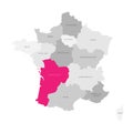
Vector color detailed map of metropolis and overseas territories of France  with administrative divisions of the country, each Royalty Free Stock Photo
Nouvelle-Aquitaine map region of France shape Royalty Free Stock Photo
Map of the french region Nouvelle-Aquitaine combined with waving french national flag - Vector Royalty Free Stock Photo
Nouvelle-Aquitaine map region of France shape Royalty Free Stock Photo
Administrative and political vector map of the region Nouvelle-Aquitaine, France.


Stockphotos.ro (c) 2025. All stock photos are provided by Dreamstime and are copyrighted by their respective owners.