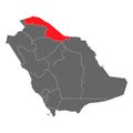
black and white silhouette map saudi arabia with borders vector illustration isolated background |
||||||||||||||||||||||||||||||||||||||||
| navigate by keyword : map saudi country border cartography vector geography outline design arabia symbol state silhouette shape asia region background isolated land icon travel graphic black contour earth nation white atlas political division territory area continent national colours concept city flat administrative simple abstract template blue sign flag topography boundary arabian infographic banner location detailed line blank world arab district middle poster label editable chart global globe department kingdom subdivision county downtown economy emblem monochrome stroke business commonwealth landmark riyadh education backdrop |
||||||||||||||||||||||||||||||||||||||||
|
||||||||||||||||||||||||||||||||||||||||
| Black and White Silhouette Map of Saudi Arabia with Country Borders, Vector Illustration in EPS Format, Isolated on White Background for Geographic and Educational Use.This vector illustration features a black and white silhouette map of Saudi Arabia with clearly marked country borders. It is designed in a simple and minimalistic style, making it ideal for educational materials, geographic studies, infographic elements, travel guides, and business presentations. The high-resolution EPS format ensures that the image can be easily resized without losing quality, making it suitable for both digital and print use. This map is useful for students, researchers, designers, and anyone needing a clean, professional, and easy-to-read map of Saudi Arabia for various purposes. |
||||||||||||||||||||||||||||||||||||||||
|
Stockphotos.ro (c) 2025. All stock photos are provided by Dreamstime and are copyrighted by their respective owners. |
||||||||||||||||||||||||||||||||||||||||